Somewhere, way up north close to Greenland, two buoys – fitted with Iridium satellite tracking devices from Trusted – are floating silently in the icy waters of the Northern Atlantic.
Their purpose? Tracking the ocean currents of these important cooling waters, and following an actual drifting ice floe to simulate the journey of the iceberg which sank the Titanic in 1912.
This is the story of how the expedition come to be. If you want to follow the buoys for yourself, you can skip to the end of the article.
An Arctic expedition to West Greenland
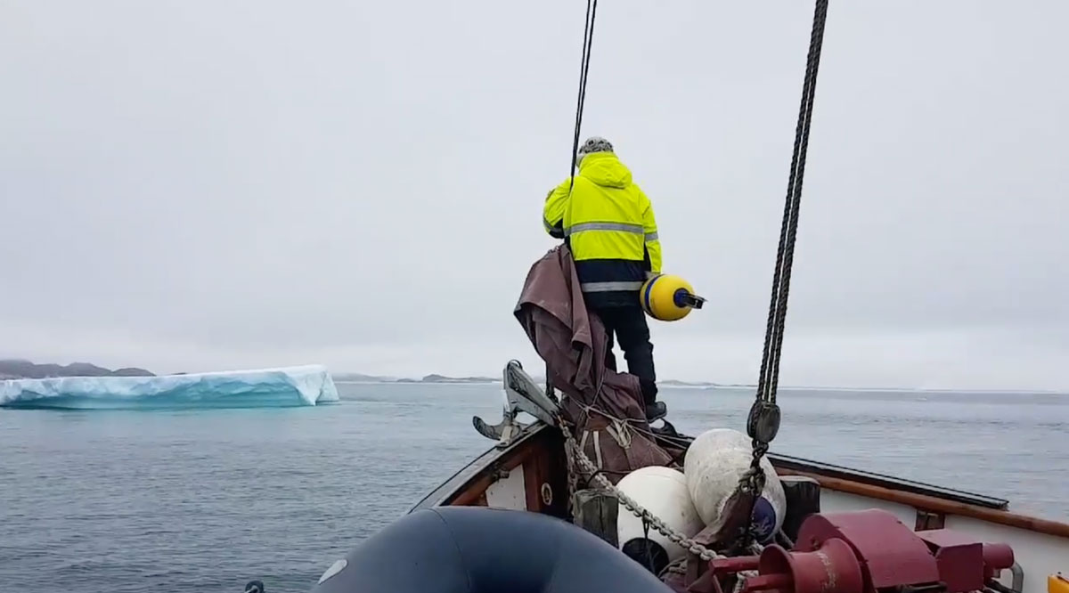
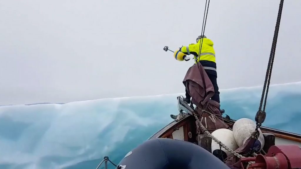
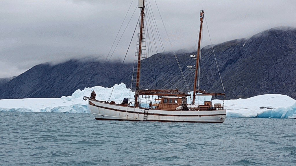
Thursday, July 19, 2018, was a very cloudy day in Qussimiut in Western Greenland. The crew was watching the beautiful Greenland icebergs from the front deck of Havella 2 after weeks at sea, preparing to throw a yellow buoy on the ice floe they sailed towards.
The idea behind this experiment came to be when Terje Nordberg, a Norwegian with a great interest in ocean currents, contacted explorer Ragnar Thorseth upon hearing about his expedition that was to take place in the summer of 2018.
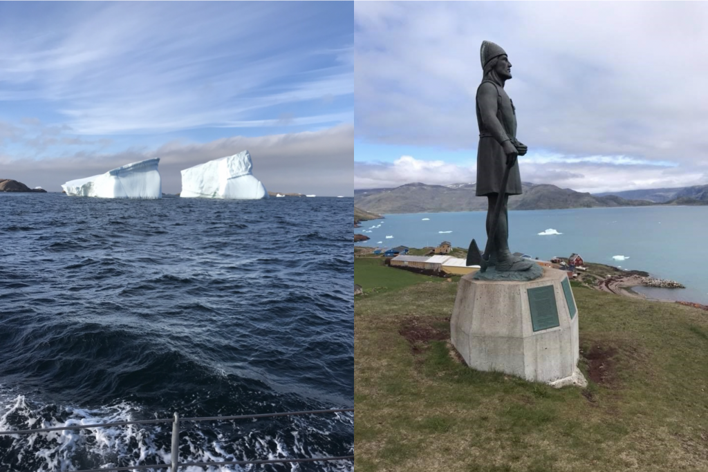
This expedition was to follow in the wake of the Viking Eric the Red from Iceland to West Greenland and experience the one-thousand-year-old Viking settlements in Brattalid, where Eric the Red settled, and his son Leif Erikson started his voyage to explore Vinland.

Ragnar Thorseth, the expedition leader on board the ship Havella 2, is known as “The Last Viking”. He has traveled with Viking ships around the world, and in fact, he was also the first Norwegian to reach the North Pole by land. His arctic experience is definitely needed when sailing among icebergs at night along the West Greenland coastline in rough weather.
The expedition to Greenland started in Norway, then sailed over to the Faroe Islands, Iceland, South Greenland, and later to North-west Greenland to Nuuk, previous Godthåb.
Tracking of ice floes and ocean currents
Terje’s purpose of the expedition, however, was to throw one buoy direct into the ocean, and place one on an iceberg with a satellite tracking device, both equipped to follow the buoys drift patterns the years to come. The yellow buoy he named Titanic, and the red buoy called Erik the Red.
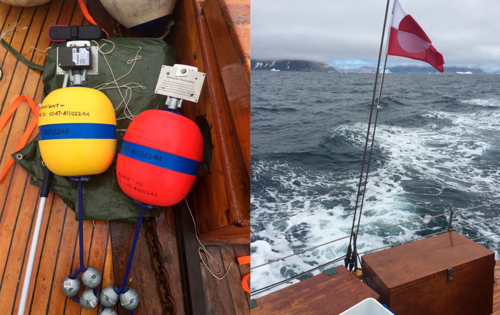
The Yellow buoy: Titanic
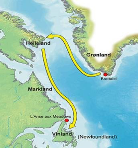
The purpose of the yellow buoy, which was thrown on the iceberg, is to simulate the route of the iceberg that sank the Titanic.
The buoy should verify the coordinates further south 41.46 N – 50.14 W, where Titanic sank in 1912, and then continue floating with the Gulf Stream back to England, where Titanic started its journey. It is believed that the iceberg originates from western Greenland.
Red buoy: Erik the Red in Brattalid
Terje is very interested in ocean currents. Therefore, he decided to follow in the wake of the Viking Erik the Red and his son Leif Erikson from their explorations of Greenland and America.
Erik the Red was the Norwegian Norse explorer who discovered Greenland. A thousand years ago, Erik the Red landed on Brattalid in Greenland and settled down.
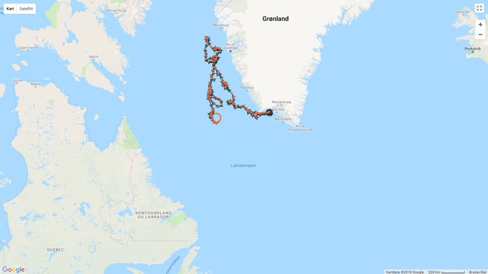
His son, Leif Erikson, later sailed from Brattalid in Greenland and discovered Vinland.
Terje further strives to follow in the wake of Leif Erikson with his buoy as Leif sailed along with the ocean currents until he came to the Viking settlements at L´anse aux Meadows in Canada/Newfoundland, first discovered by the Norwegian scientists Anne Stine and Helge Ingstad in 1960.
The map shows how Leif Erikson sailed to Vinland when he discovered America for more than a thousand years ago.
The drift patterns of the buoys
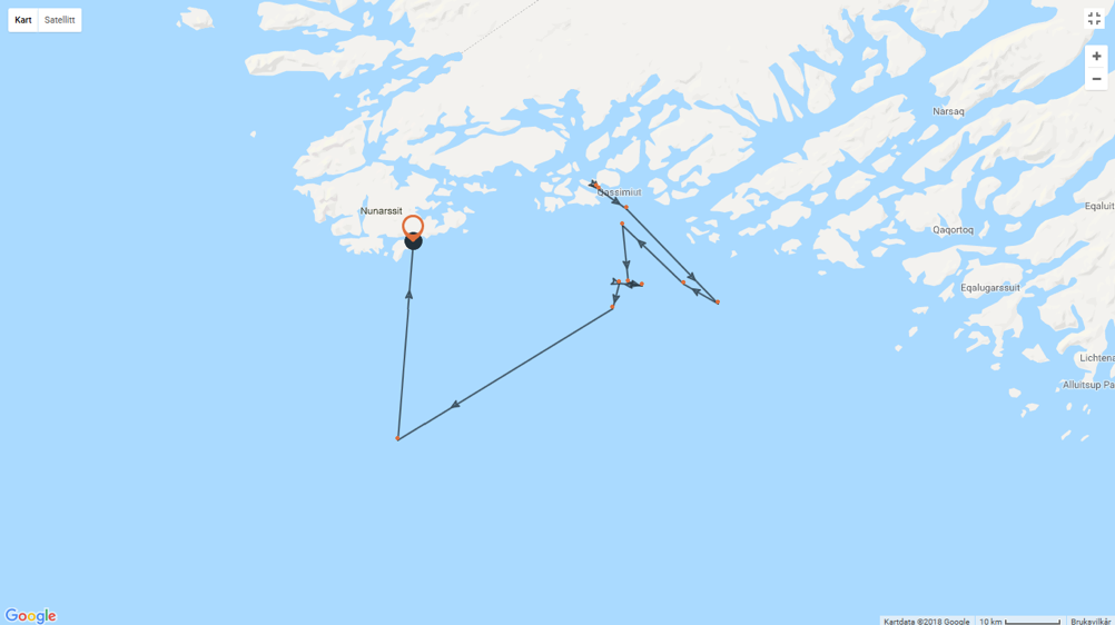
– “It is undoubtedly that the power of West Greenland coastal current goes north, and then weakens around 65N, North of Nuuk, again to returned south in the middle of the Labrador Sea, hopefully, to reach Newfoundland next year!” says Terje in November 2018, after the buoys have been drifting for 4 months.
The yellow buoy, however, seems to stand still at Nunarssit. The iceberg has most probably run aground, and it seems that it will stand still for a while, waiting for the next spring and help from a new melting summer to be released from the surface ice in the area.
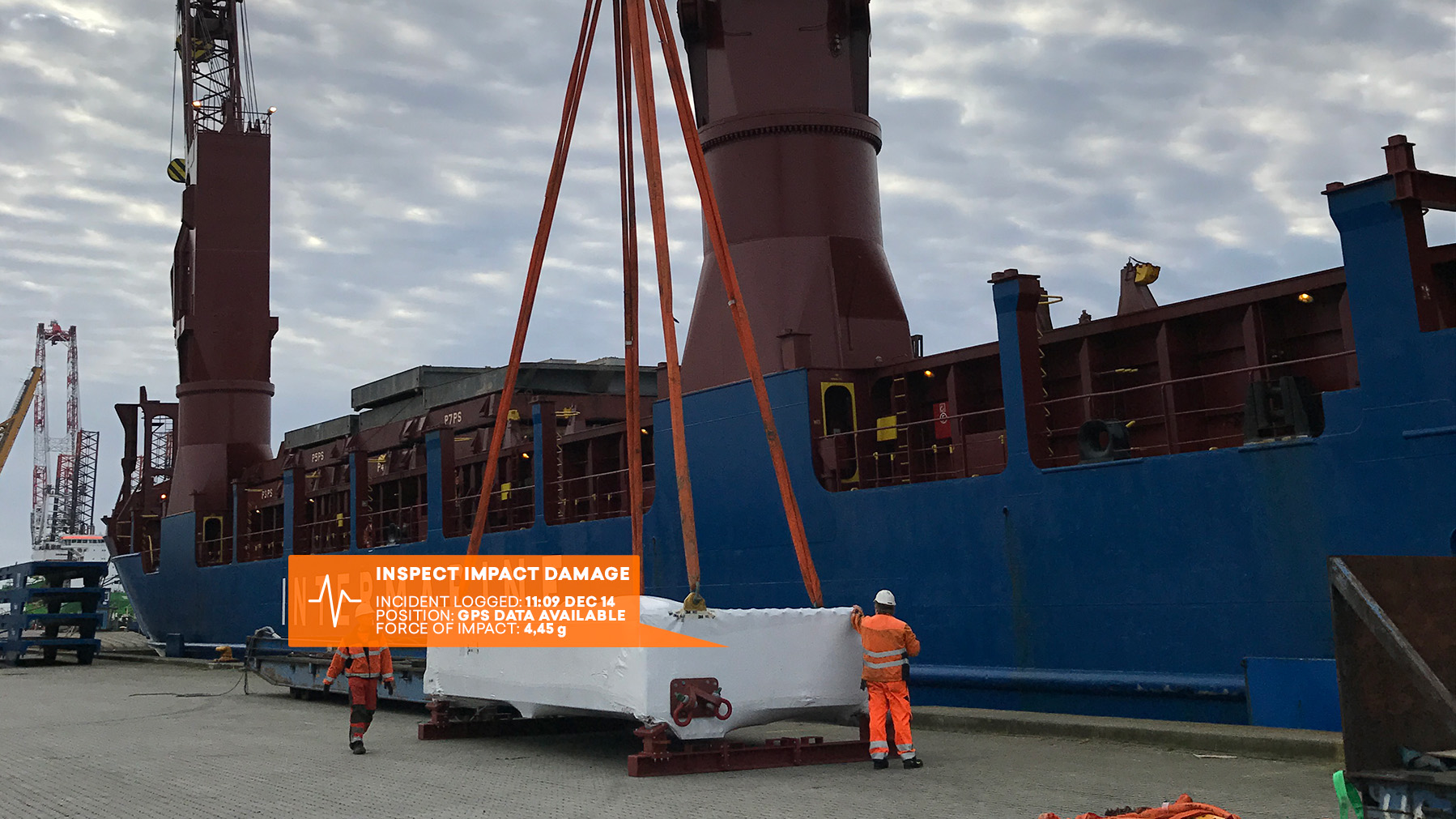
The tracking devices on the buoys are reporting a position three times a day, (every 8 hours).
The S1 tracking device is made in a very robust material that enables to resist the adverse weather conditions experienced in the north. Thereby, the tracking device secures full coverage during its journey.
Terje’s interest of the project goes five years back, where he experimented with catch and release of various message bottles to focus on ocean currents and where plastic waste in the ocean along Norway’s coast comes from and where it takes afterward.
After the expedition, Terje went straight back to Norway while Ragnar and his crew on Havella 2 had a longer journey.
They sailed back to Iceland, and from there to the Faroe Islands before returning to Norway in August 2018.
If you are interested in following the journey of the two buoys, you can follow Erik the Red here and Titanic here.
UPDATED: Read an update to this article on LinkedIn.